

This four-and-a-half-mile trek of solitude through the southern Indiana wilderness is the perfect low-key affair for recharging your batteries. Here you’ll hike to Hesitation Point and the West Lookout Tower – two of the best views in all of Brown County State Park. You might even get to sample the largest edible fruit indigenous to the United States – the pawpaw, a.k.a. the Indiana banana.
RELATED: The Best Hiking Trails in Brown County State Park, with Maps and Rankings
You can use this interactive map at the trail! Here’s how
Download map GPX file
Trail 8 (HHC Trail) map GPX file
Directions
Trail 8 (HHC Trail) trailhead. From the park’s west gate entrance, head east on W Gate Entrance Rd 3 miles to Ogle Lake Rd. Continue south 1.5 miles to the Ogle Lake parking lot. From the north gate entrance, head south on Brown County State Park Rd for 2 miles. Continue onto Horseman Camp Rd for half a mile, then turn a slight left onto Ogle Lake Rd. Follow Ogle Lake Rd 1.5 miles to the parking lot. The Trail 8 trailhead begins at the far west side of the lot by a playground.
Difficulty
Easy
Hiking Time
2 hours
Total Distance
4.5 miles
Route type
Loop
Cost
$7/vehicle (in-state), $9/vehicle (out-of-state)
Dogs
Allowed on 6-foot leash
Sun exposure
Dense tree canopy
Bathrooms
Yes
Flora/fauna
Copperheads, ticks
Accessible?
No
Kid friendly
Yes
Hiking Trail 8 (HHC Trail)
There are multiple access points to Trail 8, also sometimes referred to as HHC Trail. We prefer the Ogle Lake trailhead for both its access to permanent bathrooms and other nearby trail systems.
Starting out past the playground on the west side of the parking lot, one might be tempted to turn left down the less defined trail. Don’t. There’s nothing back there, and even if you ignore the “Do Not Enter” sign, you’ll be disappointed in what you’ll find beyond (and will probably end up getting tangled in thorns).
Heading north along the proper trail, the wide path soon narrows to a single track after the split a little more than a tenth of a mile in.
Of course, this loop can be done in either direction, but we prefer taking the northeasterly route along Upper Schooner Creek to Hesitation Point. For the next mile the trail criss crosses the creek bed – mostly dry in the summer months – until reaching a challenging wooden staircase consisting of roughly 150 steps.
Trail 8 continues to climb until reaching the junction with Walnut Trail (a mountain biking trail) and West Gate Entrance Road.
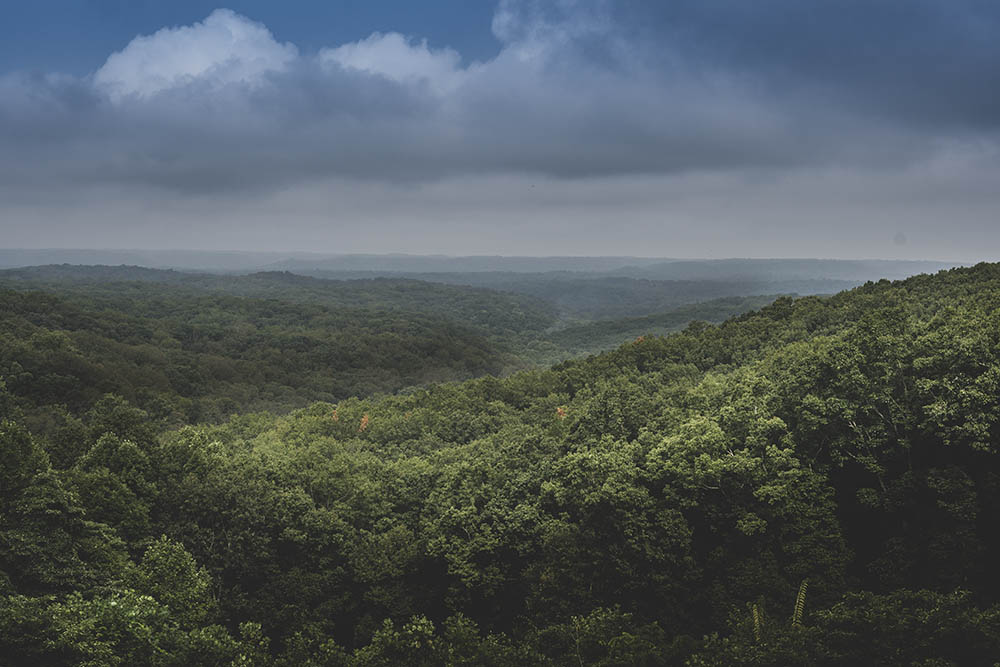
Do yourself a favor and cross the road to the Hesitation Point parking lot. And then, well, hesitate … The view of miles upon miles of tree tops undulating over valleys and hills into the distance is especially breathtaking in Autumn.
Back on the trail, the direction now turns southwest for half a mile before reaching the cut through at Tulip Tree Shelter. If you’re feeling rubber-legged at this point, taking this shortcut back to Ogle Lake will shave two miles off your hike.
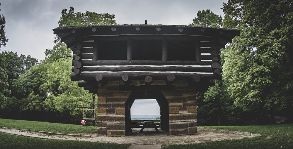
Otherwise, continue straight another mile to the West Lookout Tower. If you’ve packed food for a picnic, this is your best stop on the trail.
From the overlook you’ll backtrack a short distance before heading south on the trail for the last mile.
What’s This About Pawpaws?
The pawpaw tree is abundant in this area, and in August through October you may see some bearing fruit of the same name. It actually has multiple names, usually with a U.S. state followed by the word banana.
In these parts it’s known as the Indiana banana or Hoosier banana, but my personal favorite name for it is hillbilly mango. Now who doesn’t want to eat a hillbilly mango?
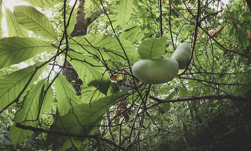
Yellowish when ripe, the inside of the fruit has a custard-like consistency reminiscent of papaya and banana. The fruit can be picked while green and left out to ripen for a few days, although if picked too early it may not ripen.
Use this map on your hike!
Load this web page on your phone while you still have service.
Then, tap the arrow icon on the map to show your current location and follow along.

Tap the layers icon to switch between topo, satellite and other helpful map layers.

To save battery life, put your device in airplane mode. GPS still works even without service!
PLEASE HELP US OUT!
If you enjoyed this free article on hikingillustrated.com, please consider
purchasing anything on Amazon via our affiliate link at no extra cost to you.
