

Don’t let the short distance of this hiking trail fool you. At Jackson-Washington State Forest, you’re in for a workout.
You can use this interactive map at the trail! Here’s how
Download map GPX file
Directions
Trail One trailhead. From US-50 in Brownstown, Indiana, take IN-250 southeast from town for two and a quarter miles. Turn left on Camp Road and follow one mile to the end of the road.
Difficulty
Strenuous
Hiking Time
45 min round trip
Total Distance
2 miles
Dogs
Allowed
Sun exposure
Dense tree canopy
Bathrooms
Yes
Flora/fauna
Copperheads, ticks, chiggers
Accessible?
No
Kid friendly
Yes
Hiking Trail One
Not only is this a cool little hike by itself, Trail One at Jackson-Washington State Forest is the perfect feeder trail for both northern and southern trail systems in the park.
Starting out at the CCC picnic grounds, the trail quickly begins to climb in elevation. Mind you, this is actually what is known as a fall line trail – a trail meant to get to a destination as quickly as possible – which unfortunately means you’ll deal with some erosion and loose footing.
It’s not that the Indiana Department of Natural Resources set out to make a bad hiking trail, rather this trail was made many years ago as the fastest route to the fire tower at the top of the hill. Of course, this method of trailblazing also creates a funnel path in which rain can collect and wash down.
After huffing and puffing the first quarter mile, you’ll be delivered to the fire tower – or at least what is left of it. Little remains but the footings of the structure.
From here the trail splits at a “T.” To the right, the route connects to Trail Two and the southern trail system. To the left, Trail One continues past Trail Ten and onward to the bald knob known as Pinnacle Peak.
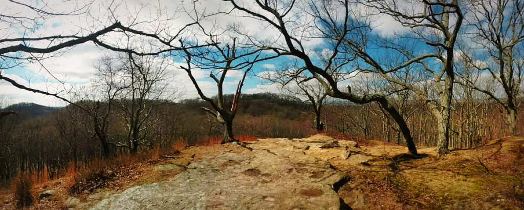
Illustrating that the DNR is attempting to remedy what fall line trails it can, a new trail now meanders around the north side of the popular peak before delivering hikers to the rocky top, which is the perfect location for a picnic or quiet contemplation.
Use this map on your hike!
Load this web page on your phone while you still have service.
Then, tap the arrow icon on the map to show your current location and follow along.

Tap the layers icon to switch between topo, satellite and other helpful map layers.

To save battery life, put your device in airplane mode. GPS still works even without service!
PLEASE HELP US OUT!
If you enjoyed this free article on hikingillustrated.com, please consider
purchasing anything on Amazon via our affiliate link at no extra cost to you.