
Trail 2 at Brown County State Park is one of the most popular hiking destinations on the grounds, passing beautiful family cabins, the North Lookout Tower and the rustic Lower Shelter. With its quaint stone bridges, retaining walls and stairways, this trail serves as the perfect introduction to Indiana’s largest state park.
RELATED: The Best Hiking Trails in Brown County State Park, with Maps and Rankings
You can use this interactive map at the trail! Here’s how
Download map GPX file
Trail 2 (CCC Trail) map GPX file
Directions
Trail 2 (CCC Trail) trailhead. From the north entrance of the park, head south on Brown County State Park Road for 1.4 miles. Turn left at the sign for Abe Martin Lodge and follow the drive .8 miles. The trailhead is behind the lodge, but to get to it you must pass through the parking lot on the right and loop around on the one-way drive to the back. There is less parking behind the lodge but the spaces are usually not full.
Difficulty
Easy
Hiking Time
2 hours
Total Distance
2.4 miles
Route type
Loop
Cost
$7/vehicle (in-state), $9/vehicle (out-of-state)
Dogs
Allowed on 6-foot leash
Sun exposure
Dense tree canopy
Bathrooms
Yes
Flora/fauna
Copperheads, timber rattlers, ticks
Accessible?
No
Kid friendly
Yes
Hiking Trail 2 (CCC Trail)
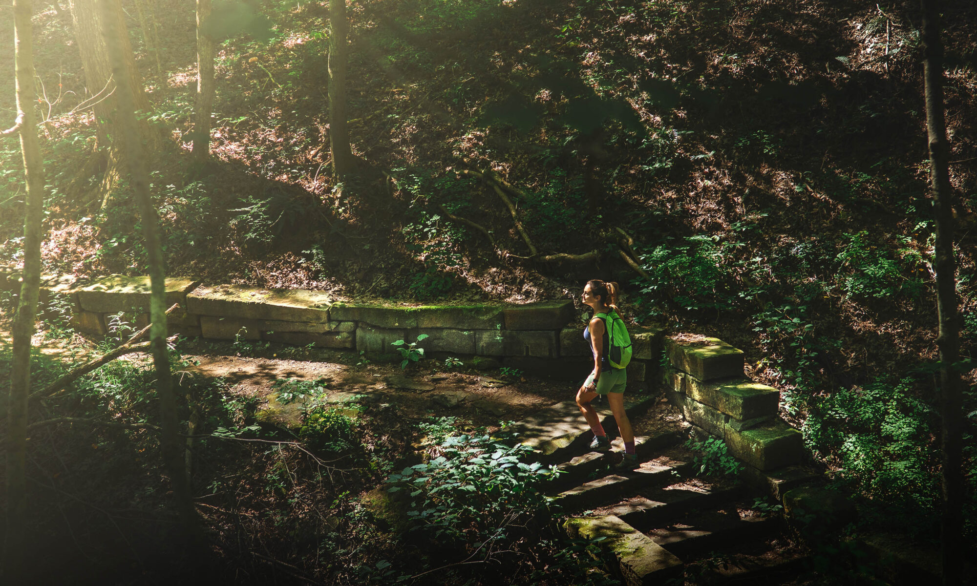
I like to call this hiking trail “The Ambassador” to Brown County State Park. It projects a warm and inviting feel to the park with its attention to detail and scale, and at the same time is quite unassuming.
The trailhead is shared with Trail 3 (a.k.a. the Saddle Barn Loop) behind Abe Martin Lodge, but after about a hundred yards the two routes split with Trail 2 heading south down into the ravine.
The trail follows the ravine for nearly a mile before climbing to Kin Hubbard Ridge, named after the popular cartoonist and journalist who created Abe Martin, a fictional poor bumpkin philosopher from Brown County.

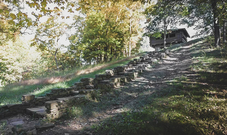
The path then follows the ridge along Brown County State Park Road a quarter mile to the North Lookout Tower – one of several beautiful vistas throughout the park. Although not part of the trail, you mustn’t resist climbing the stairs to the lookout and taking in the scenery.
I’d also recommend taking a photo of the view, which apparently I forgot to do. Oh well, next time.
From the tower it is about a three quarter mile descent to the Lower Shelter. This is where you would normally turn south and begin the climb back up to Abe Martin Lodge, however this section of the trail is closed indefinitely due to storm damage.
I use the word “indefinitely” because, well, when a park makes rather permanent-looking trail closing sign like the one below, it doesn’t seem to me that a reopening is coming any time soon.
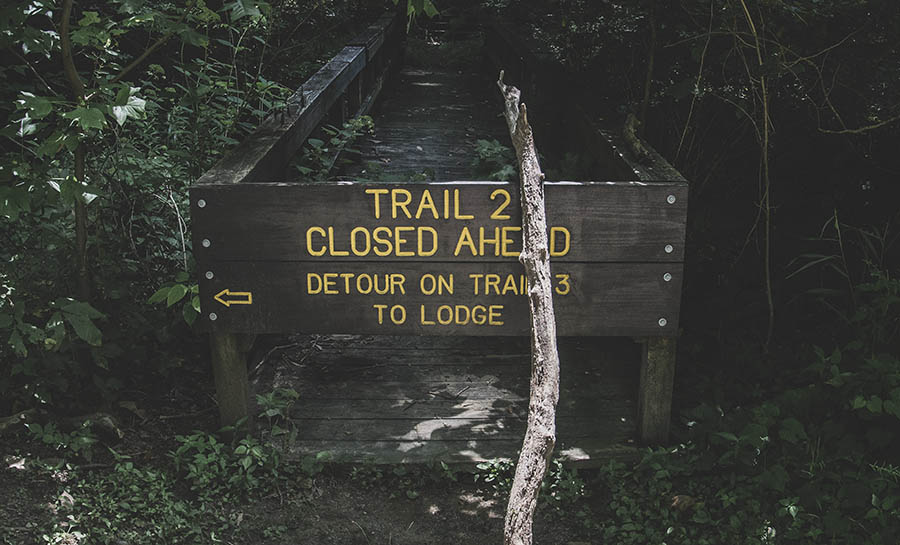
Instead, a detour leads hikers to the Saddle Barn, and from there it is a short climb on Trail 3 back to the lodge. Note that this detour adds a little less than a half mile to the trek.
If you haven’t done Trail 3 yet, rather than head back to the lodge you can continue onward for another mile and loop back to where you began Trail 2. This route will skip the amphitheater, but that feature is easily accessed by descending the northern trailhead of Trail 3.
If you’d like to combine Trail 2 and Trail 3 for a great day hike, see our Trail 3 report and interactive hiking map.
Use this map on your hike!
Load this web page on your phone while you still have service.
Then, tap the arrow icon on the map to show your current location and follow along.

Tap the layers icon to switch between topo, satellite and other helpful map layers.

To save battery life, put your device in airplane mode. GPS still works even without service!
PLEASE HELP US OUT!
If you enjoyed this free article on hikingillustrated.com, please consider
purchasing anything on Amazon via our affiliate link at no extra cost to you.


