This self-guided interpretive hiking trail begins at the Nature Center and follows 27 educational stations ranging in topics from Christmas ferns to Devil’s walking sticks.
Note: Don’t use a Devil’s walking stick as an actual walking stick. Uh, unless you’re the devil. Then it’s okay.
RELATED: The Best Hiking Trails in Brown County State Park, with Maps and Rankings
You can use this interactive map at the trail! Here’s how
Download map GPX file
Directions
Discovery Trail trailhead. From the park’s north entrance, follow Brown County State Park Road for two miles. Continue 1.5 miles on Horseman Camp Road, then straight for another mile on Parkview Lane. The Nature Center will be on the left. Follow the signs for The Discovery Trail, which begins south of the Nature Center near the parking lot entrance.
Difficulty
Easy
Hiking Time
30 min
Total Distance
.5 miles
Route type
Loop
Cost
$7/vehicle (in-state), $9/vehicle (out-of-state)
Dogs
Allowed on 6-foot leash
Sun exposure
Dense tree canopy
Bathrooms
Yes
Flora/fauna
Copperheads, timber rattlers, ticks
Accessible?
No
Kid friendly
Yes
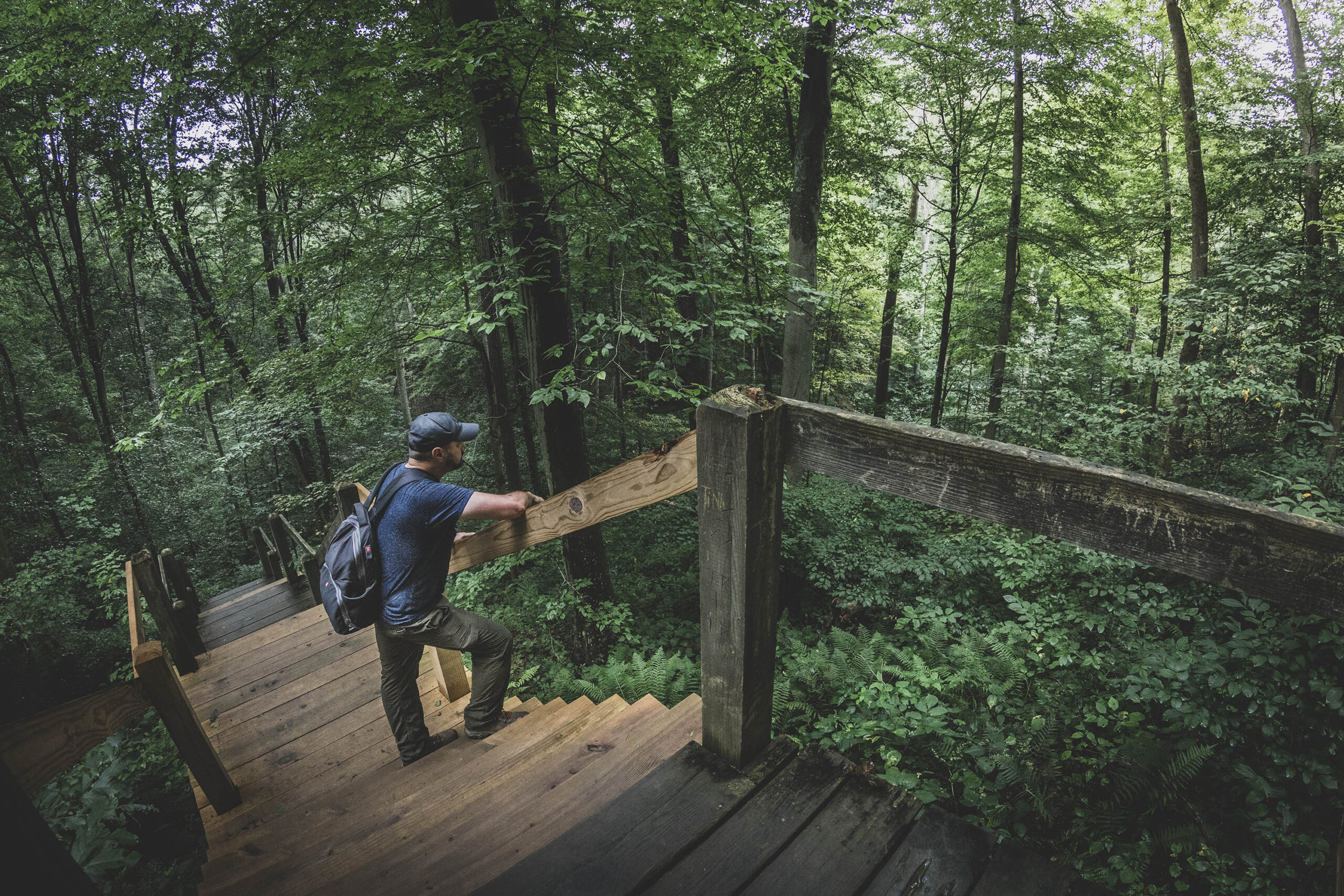
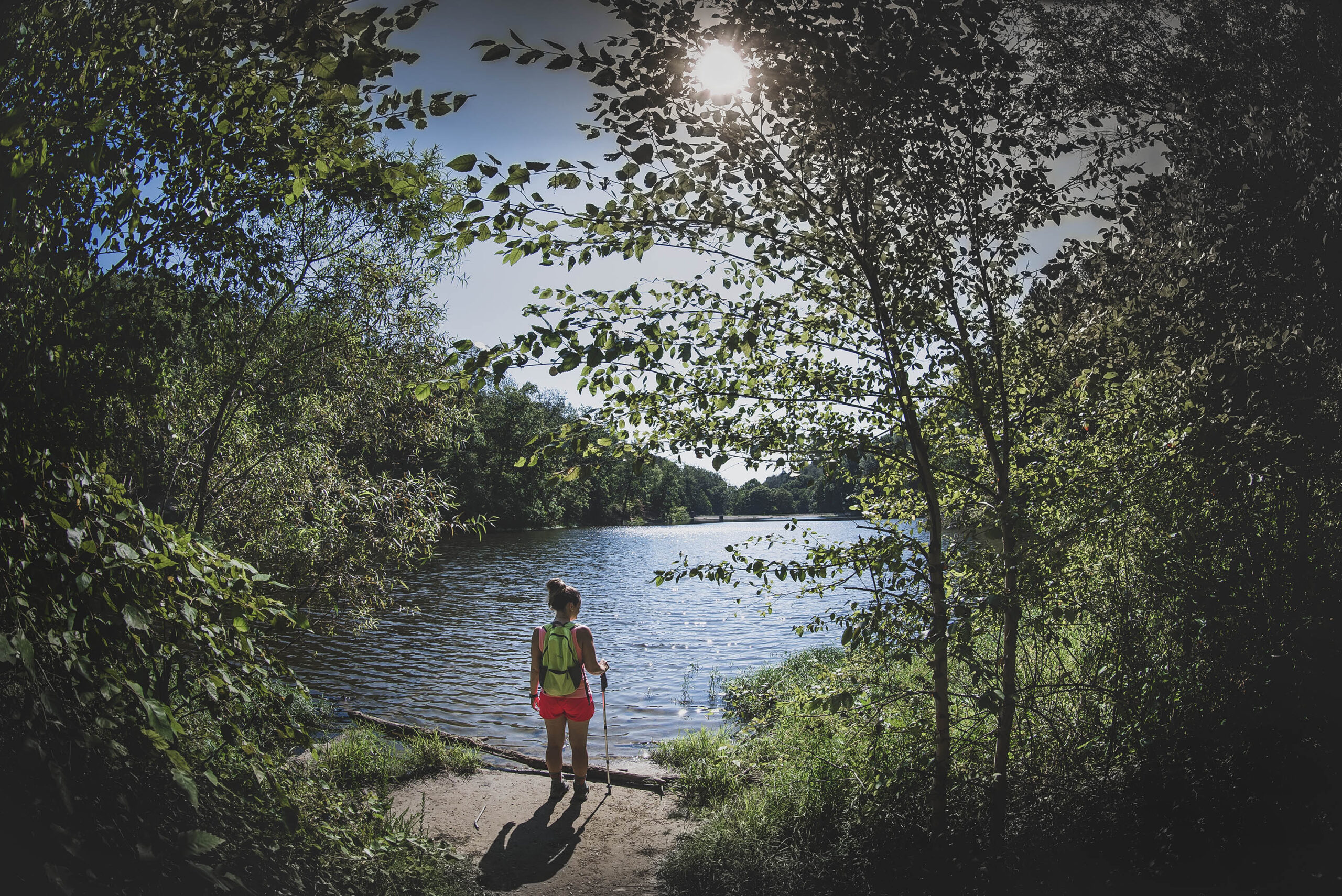
Hiking Discovery Trail
The Discovery Trail begins with a wooden box containing interpretive trail guides to follow along on your hike. Because the box is sometimes empty, we’ve included the brochure’s contents below:
Introduction
Begin this moderate 1/2 mile trail at the south end of the Nature Center parking lot. The interpretive stops on this self-guided trail were developed for your enjoyment and education.
Station 1
At the beginning of the trail, watch for two non-native invasives that you will find along the trail. Invasives are plants that grow quickly and aggressively, displacing other plants that animals need for food and cover. Invasives may permanently alter the habitat for rare wildflowers and animals. They indirectly threaten two-thirds of all endangered species. Along the trail (and throughout the park), watch for these plants:
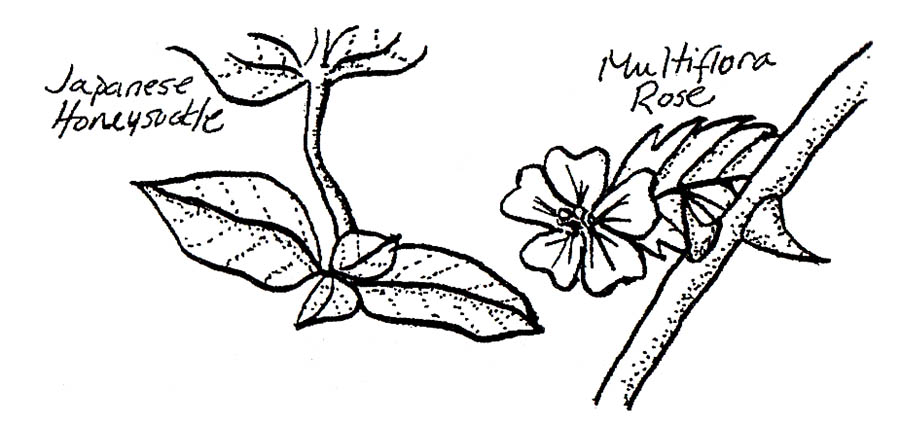
Japanese honeysuckle is a vine that grows up through trees and shrubs. it was imported as an ornamental plant for home gardens.
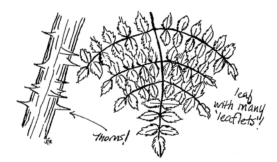
Multiflora rose is a shrub-like plant with thorns. It was often planted to form hedgerows.
Station 2
The small trees with large, oblong leaves are Pawpaws. They produce a fruit known locally as the “Indiana Banana.”
Between Stations 2 and 3
As you walk along this section of the trail, you will see some young trees mixed in with the undergrowth. Over 100 years ago this was a homestead, and the area was cleared and farmed.
Station 3
This large stone-lined depression was the well on the old homestead.
Station 4
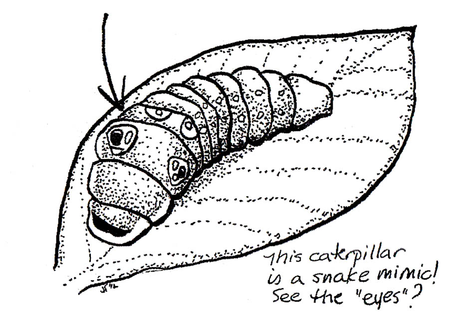
This fragrant understory shrub is called Spicebush. It provides food for over 20 species of bird and for butterfly larvae (including the Spicebush Swallowtail butterfly’s caterpillar).
Station 5
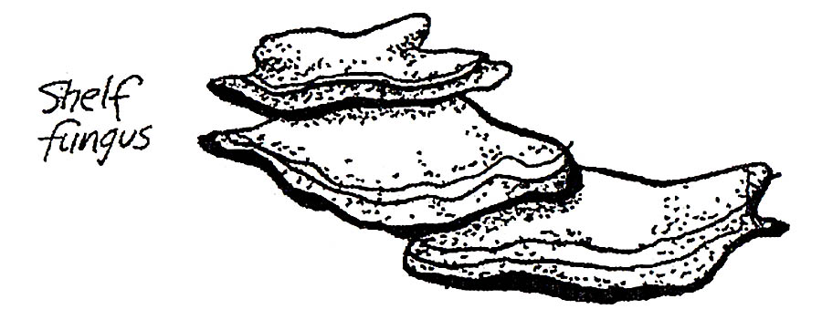
Look on tree trunks for shelf mushrooms. Mushrooms and other fungi grow on dead and dying trees. Look all along the trail for growth of other kinds of fungi.
Sation 6
The small gully running from the top of the hill on the left was caused by wear from an old horse trail.
Station 7
Try to follow the growth of these two large grapevines and count the number of trees they wind through!
Station 8
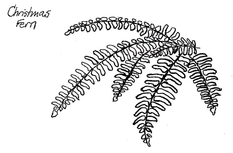
Have you noticed these plants along the trail? They are Christmas ferns. They usually grow in moist, moderately rich soil and are distinguished by small leaflets along the stems. Some people think these leaflets resemble Christmas stockings.
Station 9
The roadbed you are walking along was made by settlers years ago. The path is wider than a normal animal trail in order to be large enough for horse-drawn wagons.
Station 10
The trees on the left side of the roadbed are larger than those on the right because of the terrain; flat land was attractive to early farmers in this region. Rather than letting trees grow back after the forest was logged, this area was likely cultivated by an intrepid settler. The smaller trees have grown up since the farm was abandoned.
Station 11
Snakes, birds, chipmunks and insects might use the hole at the base of this Red Oak.
Station 12
This small tree is an American Beech. In winter, young beech trees retain most of their leaves. As you drive through the winter countryside and spot trees with smooth gray bark and light brown leaves still on their branches, you are seeing beech trees.
Station 13
Notice the thorny Devil’s walking stick shrubs?
Sation 14
Stop and rest for a moment in this quiet place. Can you smell the pine trees in the Pine Plantation behind you? It was planted in the 1930s by the Civilian Conservation Corps (CCC).
Station 15
Notice the roots of the Shagbark Hickory tree downhill from the trail, past the fallen hickory tree. They began growing outward, but then reversed and grew back under the tree in search of nutrients and water.
Station 16
There is more undergrowth uphill from the trail than downhill because the uphill side receives more sunlight.
Station 17
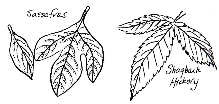
Notice the young Sassafras and Shagbark Hickory trees on the uphill side of the trail. Now look downhill. In winter, off in the distance, you can see the pine trees surrounding Strahl Lake.
Station 18
How did the large rocks get into the gulley? Perhaps farmers removed them from their fields, or the CCC placed them there to stop erosion, or they were exposed by water rushing downhill.
Station 19
Look at this tree with a joined double trunk. If you look beyond, through the V of the trunks, you’ll see dead trees full of holes created by woodpeckers.
Station 20
This American Beech (like many of its species) has been defaced by “lovers.” Cutting through the bark spoils the beauty of the tree, damages the tree’s “skin,” provides access points for pests that can do further damage and constitutes defacing state property. The love professed will probably die long before the tree does!
Station 21
Look for two things growing on or beneath this tree. One is blue-green and scaly. It is a composite, symbiotic organism caled lichen. The other is a simple yellow-green plant called moss, which has tiny leaves.
Station 22
Notice the exposed rocks at the base of this large fallen tree. Trees growing on rocky hillsides often have shallow root systems.
Station 23
Farming on these rocky hillsdies was very difficult. Try to imagine where crops might have been planted. Look at these two large rocks. It’s possible that the grooves were made by a farmer’s plow.
Station 24
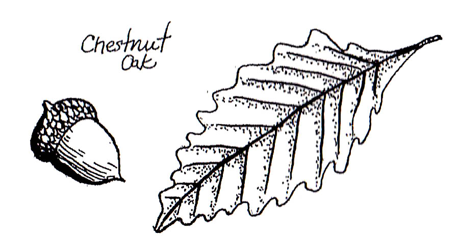
The large tree on your left is a Chestnut Oak. Oaks are valuable to both humans and animals. The tannin contained in oaks was used in tanning hides. The acorns of Chestnut Oaks are high in lipids, making them a primary source of digestible energy for wildlife. Acorns from oaks in the White oak group (a group of oaks that includes Chestnut, White and Bur Oaks) have less tannic acid than the Red oak group, and therefore taste better (and less bitter!).
Station 25
This tree is called a Shagbark Hickory. The large loose pieces of bark make this an easy tree to recognize. The bark provides places for bats to crawl under and roost during the day.
Station 26
Rest a moment by this large sandstone rock. It was formed from sediments falling to the bottom of the shallow sea. The pressure of additional sediments gradually compressed the layers into rock. Now look at the tree above you. Trees with the growth pattern of this large oak are sometimes called wolf trees. They often develop in open spaces where sunlight is abundant, whereas trees in a crowded forest grow straighter and taller to reach sunlight.
Station 27
As the path winds through this vegetation, look for Coralberry – especially in autumn – when the berries turn a bright pinkish-red.
If you enjoyed this interpretive guide, you might also be interested in visiting the Ogle Hollow Nature Preserve in the park.
Use this map on your hike!
Load this web page on your phone while you still have service.
Then, tap the arrow icon on the map to show your current location and follow along.

Tap the layers icon to switch between topo, satellite and other helpful map layers.

To save battery life, put your device in airplane mode. GPS still works even without service!
PLEASE HELP US OUT!
If you enjoyed this free article on hikingillustrated.com, please consider
purchasing anything on Amazon via our affiliate link at no extra cost to you.