

Dear Rocky, we need to talk. I love you, but you’re a bit of a hot mess …
Poor Rocky Mountain National Park has a problem: it may be too beautiful for its own good.
In July, the nation’s fourth most popular park is inundated with visitors who want to experience the majesty and tranquility of the Rockies, and who can blame them?
The 4th of July holiday landed on a Thursday in 2019, and we decided to fly out to Colorado for an extended weekend for some awesome hiking and sightseeing.
It turns out we weren’t the only ones who had this idea.
Not by a mile.
Speaking of miles …
We landed in the Mile High City in the late evening and stayed overnight just off the 16th Street Mall.
We met our friends the next morning and made the hour and a half trip northwest from Denver to Estes Park where a cozy cabin was waiting for us.
After settling in and eating a yummy pot roast our friends made, we decided to see if we could get over to the park.
We had heard that a hiker shuttle from the Estes Park Visitors Center was a good way to get into RMNP. Traffic was already a mess in town, so we hoofed it a mile from the cabin via the town river walk.
Upon our arrival at the center, a nice old man who was a volunteer informed us that the park was too busy and the hiker shuttle was behind schedule.
Way behind. He matter-of-factly told us that we shouldn’t wait because by the time we’d get into the park, we might not have time to do anything.
“Honestly, you would hate it,” he told us.
Before we left in total disappointment, he gave us a few tips on how to best get into the park at that point in the afternoon and where to go.
A glimmer of hope
“Get in your car, avoid Beaver Meadows and go to the Fall River entrance,” he said.
“Take Trail Ridge Road heading toward the Alpine Visitor Center, and see as much of the park as you can.”
We thanked him for his help and his honesty. We weren’t about to second-guess someone who told us we would hate our original plan, so we returned to our cabin to get the truck.
The Fall River entrance to the park was busy by 3:30 p.m., but it wasn’t nearly as busy as what we would see at the Beaver Meadows entrance a day later.
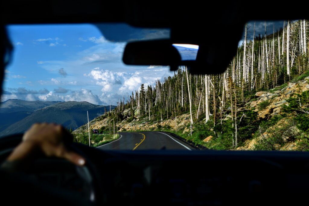
Once through the gate, traffic seemed to disperse, and we were on our way.
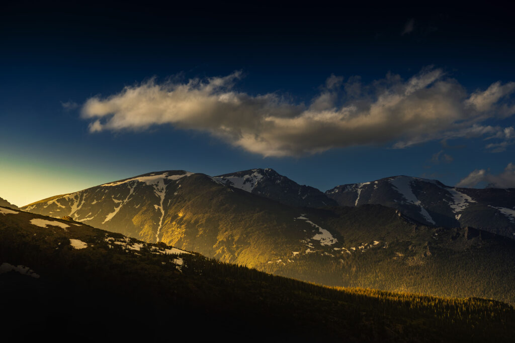
There is much to see from a vehicle, but we stopped at a couple overlooks to stretch our legs and really take in the commanding vistas of snow-capped mountains.
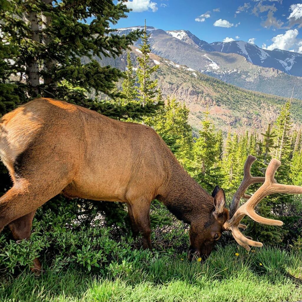
As we climbed in altitude on the winding Trail Ridge Road, we spotted a herd of elk relaxing on a patch of snow and noticed the gradual change in vegetation from montane to subalpine.
The air soon grew chilly. Our friend white-knuckled his truck along sheer drop-offs where the road apparently wasn’t wide enough to support a guard rail (the thought of snowplows on these roads boggles the mind).
An elk standing beside the highway caused a massive traffic jam as each car stopped to take pictures.
To make matters worse, a 1950s ice cream truck had also stalled in our lane, snarling traffic. It was okay though – it gave us more time to take in the scenery.
Why was that ice cream truck there, anyway?
I think that’s how they make Moose Tracks.
Ask a stupid question …
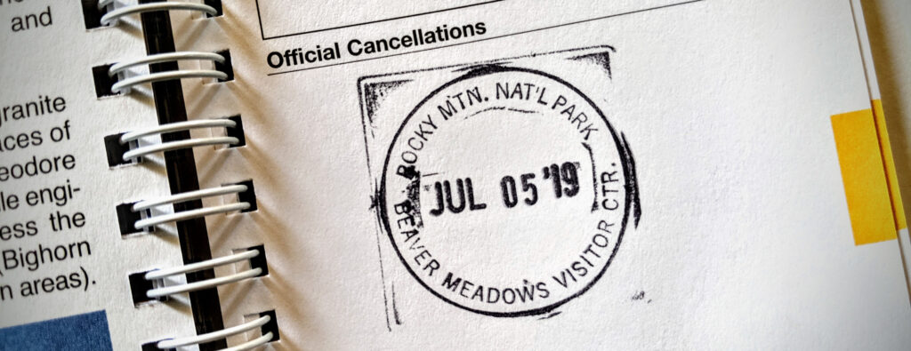
At last we reached our destination. We had just missed getting into the visitor center, which closes at 5.
There was a long line for the restroom shack next door, and we all had to go.
Now listen – this is going to sound really weird, but something I’ll never forget is sitting on a toilet at 12,000 feet and feeling the frigid alpine air whoosh up from the pits below.
Too much information?
Like a York Peppermint Pattie for your bum.
They really should make a postcard for that.
“Crapped above the tree line. Wish you were here!”
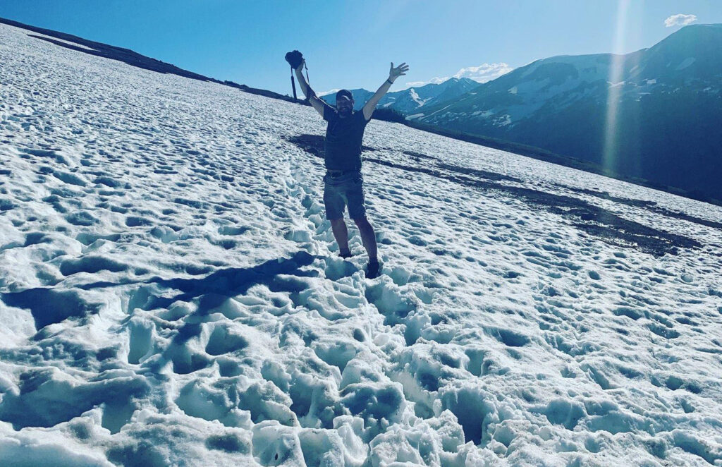
The summit
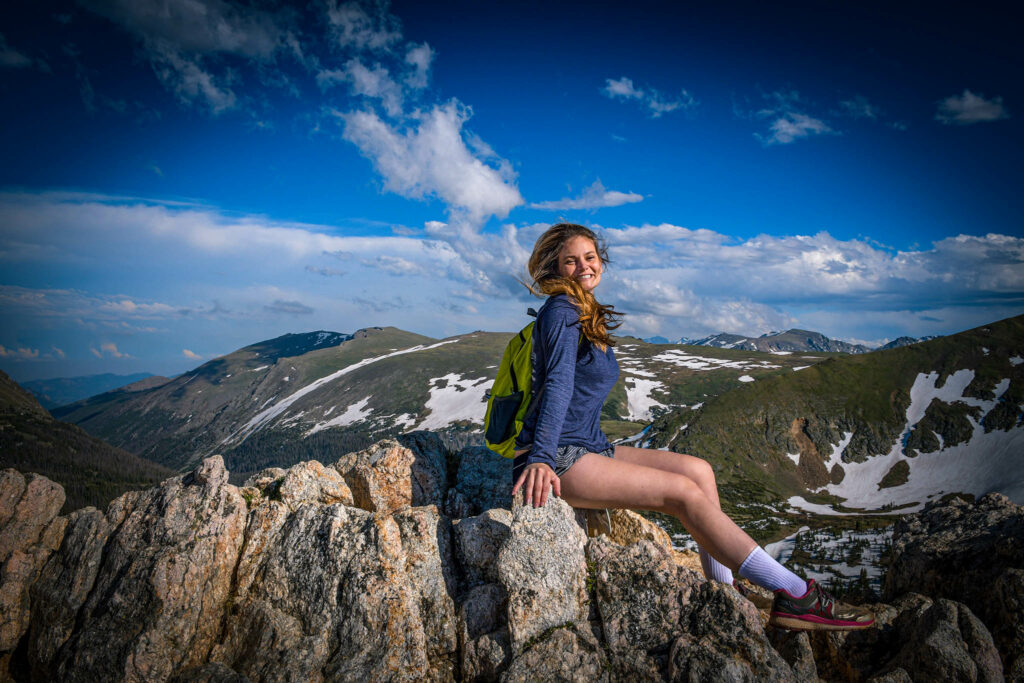
The half mile Alpine Ridge Trail begins from the visitor center parking lot. This trail, which is a long concrete staircase, has been known to be deceivingly difficult as the thin air takes its toll on those not acclimated to the altitude.
Although some of us felt the slightest bit light-headed, we all made the trek without too much difficulty. At the top we stopped for pictures beside a marker for 12,005 feet.
Whatever charm the mountaintop lost due to a lack of privacy was erased by the sheer beauty of the environment with lush green plains nearby and the Never Summer Mountains in the distance.
Despite a large crowd, no one looked unhappy in this place, and everyone seemed eager to help each other out by taking group photos when asked.
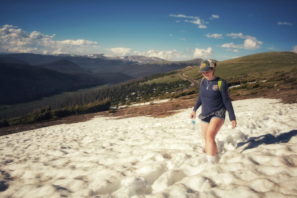
Across the road from the parking lot is the Western Ute Trail, a one-way four-miler down to Milner Pass (or a two-way trail if you want to make it a difficult eight-miler).

Our party was starting to get hungry, so we ventured only as far as a snow field (which was fairly deep in parts) before turning back, giggling along the way at the adorable marmots playing on the hillside.
We learned later that in early July the snow on this trail can be plentiful, so it was probably for the best that we didn’t attempt a thru hike since we didn’t have gaiters or microspikes.
Day two
Kat and I snuck out the door early to get a jump on the Odessa Hike, which starts at Bear Lake.
Unfortunately, we didn’t get out soon enough, as the Bear Lake parking lot was already full at 7:30 a.m.
Driving back to Park and Ride and getting on a bus to Bear Lake cost us about 45 minutes, but we weren’t the only ones caught off guard by the number of people already at the park.
We chose this time to come up with our game plan for the day.
The Odessa Hike climbs steadily for almost three miles before the turn at Lake Helene. The full thru hike end-to-end is about 9 miles.
We decided that at mile three we would assess how we felt about continuing six miles to the Fern Lake trailhead or come back the way we came.
The views of course were gorgeous, and although this was an uphill hike the elevation didn’t seem too severe.

About two miles in, the trail disappeared under a few feet of snow, and footprints from other hikers were not obvious.
We wandered a bit and were about to give up before meeting two other hikers who showed us the way. “We did the same thing,” they said.
At this point we had not seen anyone else on the trail, and although solitude in nature is something we generally appreciate, we were very thankful for these hikers who allowed us to continue on the path.
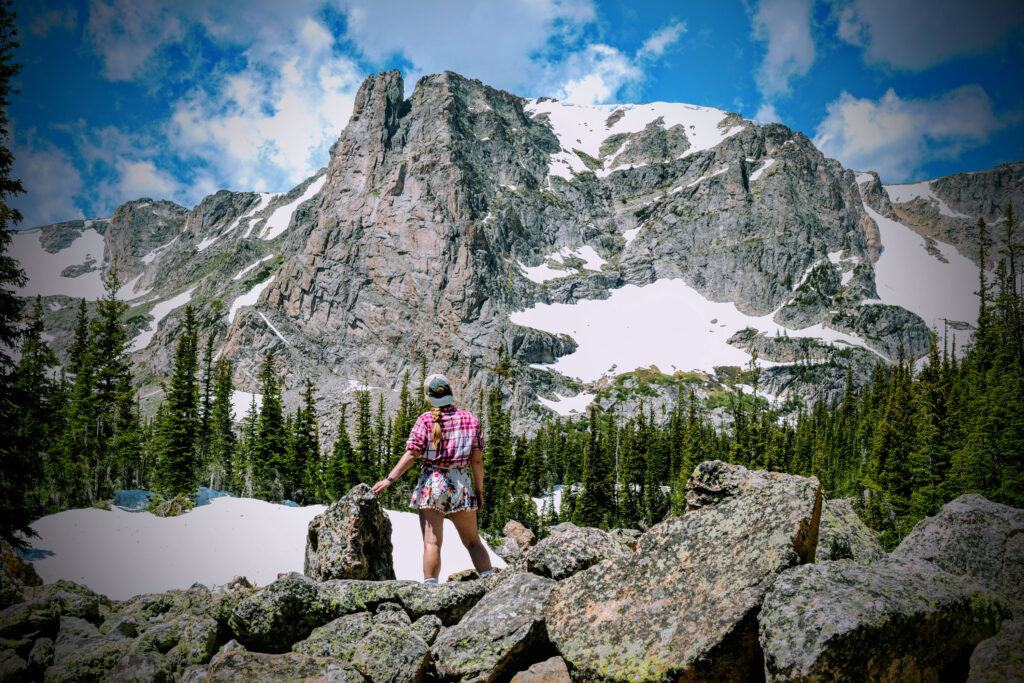
When we reached Lake Helene, we climbed a bluff atop Joe Mills Mountain to survey the valley below. From our vantage point we could see Odessa Lake.
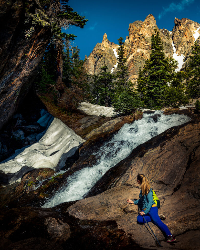
When we joined the trail again, we discovered a large expanse of deep snow on the northwest side of the mountain.
This was the kind of snow that was rapidly melting, which can be very slippery when going downhill.
Not knowing what other obstacles waited ahead of us, we made the decision to head back the way we came, hoping to one day try again.
Back where we lost the trail on the way up, we somehow managed to lose it again on the way down. We merged parties with two women who had also missed the trail.
I pulled out my phone to see if GPS could find me, and thankfully it did.
That’s one really great thing about newer phones with true GPS chips in them – they’ll still work with GPS satellites even if there is no cellular service otherwise (and there isn’t in the park).
As I turned in a clockwise motion, the glowing blue dot shined its beam up the hill toward a dotted trail line on the map. Going uphill had not been our first instinct, but we decided to split from the others who had continued downhill.
We soon located the trail again and called to the others. When they caught up with us, they looked relieved. Hikers helping hikers – it felt good to be able to pay forward the good will shown to us earlier in the day.
As the hikers passed, they told us they had come from the Fern Lake trailhead on a thru hike, which is what we had planned to do, only in reverse.
We inquired about the amount of snow on the cold side of the mountain. “It was fine going uphill, but I wouldn’t want to do it going down.”
It turns out we’d made another wise choice. Next time, if in July, we’d probably want to go the same route they had.
Leaving the park mid-day via the Beaver Meadows Entrance Station, we were amazed to see a line of cars that stretched for nearly a mile.
At the gate, rangers were turning visitors away. The park was full and there simply wasn’t anywhere left to park.
How horrible it would have been to wait in line for a mile only to be turned away. The moral of the story – get to the park early, early, early, and leave before it turns into a freeway at rush hour.
A beer sounded good after our long hike, so I stopped at a package store along the highway.
Except you bought crummy beer.
I know, I panicked when I saw what was happening inside.
Inside, a visibly frustrated store clerk was arguing with a pompous customer who was planning to drive to the top of a 14,000-foot mountain in the park (which you can’t do) in his Mustang convertible (which wouldn’t make it anyway).
The clerk happily gave him directions to the Beaver Meadows Entrance Station and, after the customer was out the door, he confided to me that he knew full well the man would be turned away at the entrance.
As cool as a mountain stream …
Yes, I screwed up on the beer.
Tap into the Rockies …
Oh hush.
Many of the locals we met during our stay seemed to be a little on edge due to the absolute crush of human souls in tiny Estes Park. I felt bad for them, and I tried to be extra mindful as a guest in their sweet little town.
Day Three
Kat’s long-time friend and bridesmaid now lives in Colorado and has a yearly pass to the park. We accompanied her on our last full day of our trip to do the hike to Emerald Lake, one of the most popular trails in the park.
She knew it was going to be extra busy again that day, so we set out for the trails even earlier. We were a little surprised to be greeted with electronic signs stating that the Bear Lake parking lot was already full at 7 a.m.
The signs had not been there on the previous day, so we were at least thankful to not waste our time. We headed directly to the Park and Ride lot and quickly caught a bus to our final destination.

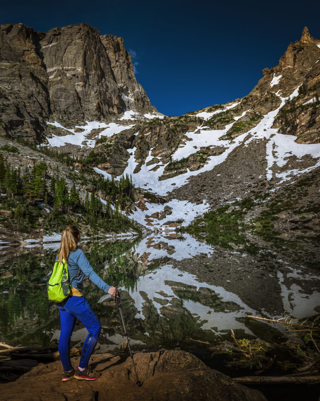
There is a reason this trail is so popular – it’s flat-out gorgeous. Or, as Kat’s girlfriend put it, “majestic as f#ck.”
Even with an early start the crowd was starting to thicken, so we tried not to linger too long at the many viewing points. Half a mile into the trail we encountered Nymph Lake, so-called for the abundance of lily pads on its surface.
About another half mile ahead is Dream Lake, and finally the trail culminates with the dramatic show-stopper Emerald Lake where the faces of Flattop Mountain and Hallet Peak reflect in its near perfect mirror-like surface.
We lingered here along with many others, breathing in the fresh air and marveling at nature’s beauty. Many great photographers have taken gorgeous photos of this place, but actually being there to see it in person is a true feast for the eyes.
A gentle calmness overcomes the mind, and once it adjusts to the environment, that’s when you notice the waterfall that you’ll likely never detect in a still image.
Just before you slip into a peaceful trance, you’re jarred back to reality by a man smoking a cigarette, a teenager carving his name into a nearby tree and the rustle of a plastic bag someone dropped on the ground.
Or maybe none of that happened and it just feels like it could happen if something isn’t done soon to control the masses.
We might be killing this park by loving it too much. We may soon see timed permits and tighter vehicle restrictions in an effort to curb this influx of humanity at Rocky Mountain National Park.
It is a shame but will likely soon be necessary, and other national parks are already leading the way. I think the folks at Estes Park would especially welcome it.
We don’t want to be too discouraging about the crowds, but when we go back (and there will definitely be a trip back), we will probably avoid peak visiting months.
But if we do find ourselves at RMNP in July, we’ll be more prepared to get lost from the crowds without getting lost in the park.
Promo time
We really enjoyed the book “Hiking Rocky Mountain National Park: The Essential Guide” by Eric Stensland.
We purchased it before our trip, and it was super helpful for planning our day hikes because it ranks trails from easiest to hardest and comes with excellent descriptions and handy elevation profile graphs.
At our cabin, our host had numerous trail books and maps for us to use, but nothing compared to this definitive resource. The author has personally hiked every trail, and his photography of each location is simply gorgeous.
We can’t recommend his book enough, and if you’re in Estes Park, you should also stop by his shop. We browsed his store and purchased a large photography print of his that is now hanging proudly in our home.
PLEASE HELP US OUT!
If you enjoyed this free article on hikingillustrated.com, please consider
purchasing anything on Amazon via our affiliate link at no extra cost to you.

Loving these interactive topographic maps! Are those Google Maps?
Hi Julia! Thanks! They’re actually MapBox maps. I love them because they’re free (for most of us), fairly easy to build and embed, and they show WAY more detailed trail info. I’d be happy to build you something if you’d like. ?